Travel by Any Means Necessary

Category: Camping Page 3 of 5

Off Season Camping

Autumn at Tahquamenon Falls

Now is the time of year where people start clamoring to get the perfect summer campsite. Michigan State Parks 6 month reservation window is open now for summer and all over the internet, campers are posting about the difficulties of getting their favorite spot. All this hype makes it really hard to get into the popular campgrounds especially over the busy weekends. There is one way sure fire way to avoid all this hassle: camp in the off season. Camping in Michigan outside of the summer, you practically have the campgrounds to yourself.

The slowest season for camping is definitely winter. Winter brings less options as some campgrounds close completely while others limit availability. Many campgrounds that remain open close the bath houses in winter as well. Of course, winter camping brings lower temperatures and snow (although not much of that yet this year) so you need to be prepared with a quality tent and sleeping bag rated for the cold. Bring your snowshoes or cross country skis and take to the trails during the daylight. If you are prepared for it, camping in the winter is a unique experience.

For those who are not that hearty, spring and fall are less busy than the summer, but more comfortable than winter. And if you are able to go during the week, you might not have many neighbors. Last May we took an impromptu one night camping trip at Holly Rec just to get out of the house. There were a few other campers around, but it was much calmer than the summer and we were able to walk right in and get a spot without booking months in advance.

Of course, camping in Michigan in the fall adds a whole other layer to the experience. The trees put on a show that dress up the campgrounds. I love going up to the Upper Peninsula in the fall. The colors really add another layer to an already beautiful wilderness. We camped at Tahquamenon Falls a few years ago in the fall and there were only a handful of other campers around after the weekend. Of course, it gets chilly up there in the fall so you need to be prepared for it, but the views make it worth it!

Thank you for stopping by! If you like my photos be sure to “like” my Facebook Page, follow me on Instagram, and Flickr! You can purchase prints on Etsy and Fine Art America. To see inside my camera bag, check out my Gear Page. For information about our new Guided Photography Tours, visit GuidedPhoto.com.

Acadia National Park: Park Loop Road

Thunder Hole at Acadia National Park

After we left Salem, we headed North to Maine. Upon first entering the state, I fell in love. There is something breathtaking and different about Coastal Maine. It looks like a mountain range, but smells like the beach. It was unlike anything I had ever experienced before. We arrived at Acadia and set up camp at Seawall Campground, which is located on the “quiet side” of the island. I didn’t really understand why they call it that until the next day.

Our first full day at Acadia was dedicated to driving the Park Loop Road. The Park Loop Road is the 27 mile road John D. Rockefeller Jr. built around Mount Desert Island so visitors can explore the park by automobile (instead of driving cars on the miles of the park’s carriage roads). We began our tour at the Hulls Cove Visitor Center. While at the visitor center, we picked up an audio tour of the park look road to listen to on our drive. I really enjoyed it because we learned some history of the park as well as some information about natural side of Acadia. Also at the visitor center, we got our first taste of Acadia’s summer crowds. Holy Cow. Before this trip, I read Moon’s Acadia National Park Travel Guide and it mentioned that July and August are the busiest times to visit Acadia. I went into it picturing the Sleeping Bear Dunes on Labor Day but it was more like Disney World around Christmas. Parking lots were packed. As you can see in the Thunder Hole picture above, people were just everywhere. Truly, trying to get a clear picture was like trying to get a picture of Cinderella’s Castle without the people in it. It just wasn’t going to happen. Between the crowds and the heat, I really struggled with photographic inspiration in one of the most beautiful places I have ever seen.

Schooner Head Overlook at Acadia National Park

The Moon book really pushed for visitors to use the free Island Explorer Buses (sponsored by L.L. Bean). They reduce emissions and help with the crowded parking lots. We decided for our first day in the park we would drive the Park Loop Road to give us the flexibility to stop and see anything we wanted to see. One of our first stops was the Schooner Head Overlook (left). Compared to the rest of the park and other sections of the Park Loop road, this was a very quiet spot. We only saw a few people on the trail, one of which was setting up an easel to paint. This would be a great place to watch a beautiful Acadia sunrise and to catch the first rays of sun in the United States.

Of course, we had to stop at Thunder Hole (above). It was very cool to hear the waves thundering into the natural rock inlet. It really does sound like thunder. We wanted to stop at Sand Beach and see the only sandy beach in the park, but we couldn’t find a parking spot, so we kept driving. If you are looking to visit Sand Beach, I highly recommend taking the Island Explorer because we visited around 9 the next morning and the parking lot was already full.

Crowds aside, I do recommend driving the Park Loop Road at least once because the Island Explorer bus doesn’t stop at every place you may want to see. In particular, the bus does not go to the top of Cadillac Mountain, so if you want to see the highest peak on the east coast (and if you’re in Acadia, you should) you can only get there by car or by climbing it. Personally, I don’t hike something if I can drive it and I definitely don’t hike up the side of a mountain, so we drove and that is the topic for next week! Be sure to come back to hear all about it!

If you like my photos be sure to “like” my Facebook Page, follow me on Instagram, and Flickr! You can purchase prints on Etsy and Fine Art America. To see inside my camera bag, check out my Gear Page. For information about our new Guided Photography Tours, visit GuidedPhoto.com.

Hiking Hocking Hills: Ash Cave

Ash Cave

The Ash Cave Gorge Trail is probably the easiest hike at Hocking Hills State Park. The quarter mile, ADA accessible trail takes you almost all the way to the falls. The accessibility of this trail makes it a popular site as can be seen from the above photo. Of course, this spot wouldn’t be so popular if it wasn’t stunning. At 700 feet from end to end and the rim rising 90 feet from the ground, Ash Cave is the largest recessed cave in the state of Ohio. Of course, there are more challenging ways to explore Ash Cave as well. Climb 64 steps on the Rim Trail for get a view of the cave from above. (HockingHills.com)

It was forecast to rain the whole time we were in Hocking Hills. When we woke up on our first full day in the park and the rain hadn’t started, we quickly got ready and headed to the trails. Our plan was to see as much as we could before the rain

Ash Cavestarted and then head back to camp. I had learned since our time at Port Crescent last summer and I brought things to do in the tent to occupy us during the rain. Miraculously, it didn’t rain at all that day and we were able to explore everything we had hoped. What is my point? Don’t look at the weather forecast and cancel your plans! According to the meteorologists there was a 100% chance of rain that day and it didn’t actually start until after the sun went down. We could have cancelled the trip and stayed home but we would have missed these cool sites and some beautiful weather. Of course, that’s not always the case so you need to have a plan for rain. That can be tough tent camping, but some books, a pack of cards, and a rain coat should keep you occupied for a bit.

To plan your trip to Hocking Hills, visit HockingHills.com.  Read more in my Hiking Hocking Hills Series: Camping & Hiking Hocking HillsCedar Falls, Conkle’s Hollow, Rock House and Old Man’s Cave (coming soon). If you like my photos be sure to “like” my Facebook Page, follow me on Instagram, and Flickr! You can purchase prints on Etsy and Fine Art America. To see inside my camera bag, check out my Gear Page. For information about our new Guided Photography Tours, visit GuidedPhoto.com.

Pin it!

Camping and Hiking Hocking Hills

Cave Waterfall

Hocking Hills State Park is a geological gem in southeast Ohio. As someone who has spent a fair amount of time in Ohio over the years, this area does not feel like Ohio. It felt like a cross between the Pictured Rocks area in the Upper Peninsula and Natural Bridge in Kentucky. Paths and hiking trails weave through sandstone rock formations and around waterfalls to stunning, sometimes otherworldly, vistas. The park is full of towering sandstone cliffs, caves, and amazing waterfalls.

There is an experience at Hocking Hills for all abilities and interests from a leisurely stroll to a more rigorous hike. The trails to Ash Cave, Cedar Falls, and Conkle’s Hollow are easy, paved, and have rewarding views at the end. Old Man’s Cave (featured above) is a little more difficult with some beautiful bridges to cross and carved sandstone steps. We hiked Old Man’s Cave during a drizzle and it felt all encompassing and surreal. Rock House was the most challenging hike we did. It involved climbing narrow, boulder-like steps to an amazing cave-like rock formation that once was a hideaway for bandits. If you are even more adventurous, Cantwell Cliffs and The Hemlock Bridge Trail are more longer, more challenging trails with many steps leading to unique locations in the park. If you are looking to make a full day out of hiking, the Grandma Gatewood Trail connects a lot of the sites so you don’t even need a car to see them all.

During our time in Hocking Hills, we stayed in the Old Man’s Cave Family Campground Hike-in Sites. The hike-in sites are outside of the main campground at the mountain bike trailhead. The sites are fairly well spread out and most of them have a good deal of privacy. The four sites closest to the parking lot are first come first serve and the farthest site back is a good .8 mile walk from the parking lot with many sites in between. The path to the hike-in sites is gravel and a wagon is an easy way to transport your gear to your site. Even though the hike-in sites are separate from the main campground, hke-in campers are given main campground privileges such as use of the shower house and pool. I would definitely recommend the hike-in sites to tent campers that don’t require an electrical hookup because the sites at the main campground are very close together and lack privacy.

Read more in my Hiking Hocking Hills Series: Ash Cave, Cedar Falls, Conkle’s Hollow, Rock House and Old Man’s Cave (coming soon). For more information about the Hocking Hills Area visit HockingHills,com. Thanks for stopping by! If you like my photos be sure to “like” my Facebook Page, follow me on Instagram, and Flickr! You can purchase prints on Etsy and Fine Art America. To see inside my camera bag, check out my Gear Page. For information about our new Guided Photography Tours, visit GuidedPhoto.com.

Pin This!

Early Season Camping

Spring is in the Air

Trees at Crosswinds Marsh

This past weekend, we made our inaugural camping trip of the season. The weather was beautiful and I just had the itch to get out and sleep under the stars. We drove to Holly Recreation Area just in time to set up camp in daylight and have a campfire. One of the nice things about camping near home is the reduced travel time gives you more time in camp. Since we don’t typically camp just to camp but to explore, we don’t usually stay overnight at our local parks. This was my first time at Holly Recreation Area and it was very quiet this early in the season. I look forward to returning in the future, maybe for another low key camping trip. Who knows?

If you are ever doing a spur of the moment camping trip like this, I have a few little tips for you. I would recommend checking availability online before you leave. We were planning on going to Highland Recreation Area but after looking on the website, we discovered that to camp there in April and May you have to bring a horse. I was very glad I checked this before we left and we didn’t drive all the way out there before learning that. And of course, you could get all the way out to a campground only to find out that they are full and that wouldn’t be good either. So, I suggest that you check the website before you leave, but do not book a last minute trip online. Most campground reservation systems charge you a processing fee, but if you book at the campground they do not. By booking at the park, we saved some money and it didn’t take any additional time to check in.

Just for clarification, the above photo is from Crosswinds Marsh not Holly Recreation Area. We weren’t really at the park long enough to explore and take pictures. Maybe we will come back another time to capture it and share it here.

If you like my photos be sure to “like” my Facebook Page, follow me on Instagram, and Flickr! You can purchase prints on Etsy and Fine Art America. To see inside my camera bag, check out my Gear Page. For information about our new Guided Photography Tours, visit GuidedPhoto.com.

Spring is in the Air!

Big Pink Flower

I think it may finally be spring here in Michigan, although there is snow in the 10 day forecast, but I’m just going to pretend I don’t see that and hope it goes away. The longer days and warmer weather mean its time to start planning our summer trips! So far, I have a cruise on the calendar towards the end of summer. In July, I’ve booked a weekend camping trip at Straits State Park in St. Ignace. I am so excited to sit around the campfire under the lights of the Mackinac Bridge again!

We are also talking about heading down to the Hocking Hills in June. I have seen beautiful photos of the scenery there and I would really like to capture it! The park in southern Ohio is full of stunning waterfalls, unique rock formations, and miles of hiking trails.

The final trip of the summer that I am planning is a camping trip in the Porcupine Mountains in the western Upper Peninsula. I have heard so much about the area but the seven hour plus drive is a real deterrent. I am hoping this summer to finally overcome that obstacle and experience Lake of the Clouds and Bond Falls myself.

Where are you planning to visit this summer? Let me know in the comments! If you like my photos be sure to “like” my Facebook Page, follow me on Instagram, and Flickr! To see inside my camera bag, check out my Gear Page. For information about our new Guided Photography Tours, visit GuidedPhoto.com.

Mackinaw City

Old Mackinac Point

For Labor Day this year we camped at Wilderness State Park near Mackinaw City. There is a lot to see and do in that area and I was excited to spend a long weekend exploring it! We stayed for three nights and I realized that with two summer road trips, three nights was the longest we had stayed in one place on a trip since our cruise in 2015. That is, if you count a cruise as staying in one place. If not, you would have to go back to our Disney World trip in 2014. Obviously, we prefer to move when we travel.

I really enjoyed our stay at Wilderness State Park. We stayed in one of the new tent sites that are right on Lake Huron. It was like having our very own beach! We had a great long weekend and Wilderness was quickly added to our list of favorite campgrounds!

The above photo was taken at the Old Mackinac Point Lighthouse. Its a picturesque lighthouse that sits right near the base of the Mackinac Bridge in Michilimackinac State Park. If you are in the area, I recommend that you visit the park and the fort there, but I wouldn’t recommend spending your money visiting the lighthouse, and this is coming from someone who LOVES Michigan lighthouses. The thing that threw me about visiting the lighthouse is that climbing the lighthouse is not guaranteed with admission. Luckily, we got to climb but the way they do tours, it was so crowded at the top, it was hard to take pictures and by the time the whole group got up there, I just wanted to go back down. If you are a lighthouse fan like me, go to Michilimackinac State Park and photograph the lighthouse from outside the fence, and if you want to climb a lighthouse, head two miles out of the city to McGulpin Point Lighthouse, which I will review in a later post! Be sure to check back later so you don’t miss it!

Thanks for stopping by! For more information about Wildnerness State Park visit the DNR. To plan your trip to Michilimackinac State Park, visit MackinacParks.com. If you like my photos be sure to “like” my Facebook Page, follow me on Instagram, and Flickr! To see inside my camera bag, check out my Gear Page. For information about our new Guided Photography Tours, visit GuidedPhoto.com.

Pin this!


B&B Trip Report: Harpers Ferry

Shenandoah Vista

We had planned to get into Harpers Ferry in the early afternoon so we had time to explore the National Park and Lower Town. Unfortunately, this was Saturday of Fourth of July weekend and traffic getting out of the Outer Banks was unbearable. We didn’t end up getting to Harpers Ferry until early evening and it really limited what we were able to see on our last two days.

We did arrive in time to explore Lower Town. Walking around lower town, you can practically feel the history. Our favorite place was the True Treats Historic Candy shop. Susan, the owner of the shop was standing by to tell us the story of the shop and give us a brief history lesson. It is the only research-based historic candy shop in the country and a trip to Harpers Ferry would not be complete without picking up a sweet treat to take home with you!

After walking around the town, we got back in the car and headed to our final campground of the trip, Owen’s Creek Campground. Owen’s creek is a tent only campground that is wooded and was surprisingly quiet for a holiday weekend. Interestingly, the campground is located on the same piece of land that houses Camp David. If you’re looking for a place to camp in the Harpers Ferry area, Owen’s Creek was the only one I could find that accepted reservations without a minimum stay. Anyway, I really enjoyed our stay here (especially the shade and the reprieve from the heat) and would definitely stay here again.

Thanks for stopping by! If you like my photos be sure to “like” my Facebook Page, follow me on Instagram, and Flickr! To see inside my camera bag, check out my Gear Page. For information about our new Guided Photography Tours, visit GuidedPhoto.com.

B&B Trip Report: Bodie Island

Bodie Island

The hottest day of the trip, we got on the Ferry from Ocracoke and began heading south. Our first stop of the day was at the Bodie Island Lighthouse. The lighthouse is located south of Nags Head near Oregon Inlet. Because of the heat, we chose not the climb it, but we did walk out to the marsh overlook.

In 1837, a search began for a spot for another lighthouse along the dangerous Outer Banks. They settled on a location in Pea Island, on the other side of Oregon Inlet because Lieutenant Napoleon L. Coste, the leader of the expedition said “more vessels are lost there than on any other part of our coast.” Soon after construction began, there were major structural problems and within a few years, the tower began to lean and the lighthouse was abandoned. A second lighthouse was commissioned nearby, but only two years later, it was destroyed by Confederate soldiers during the Civil War. The current lighthouse became operational in its current location in 1872.

I really wanted to come back here and attempt to get a night sky shot of the lighthouse, like the Hatteras Lighthouse shot. But, unfortunately, it rained all night long so we missed our chance. I will have to come back and try again another time.

For this stop on our trip, we camped near the lighthouse at Oregon Inlet campground. I was nervous about this campground because there’s a warning on the website about the 24/7 construction that is happening on the Bonner Bridge (the bridge that spans Oregon Inlet) but I didn’t notice either the light or the noise. It is really hard for me to separate my feeling about this campground from the incessant heat that day. At this point in the trip, I learned that I was not made to tent camp on the beach in the summer and I was ready to head back north. The last time we were in the Outer Banks, this was one of my favorite campgrounds.

Thanks for stopping by! If you like my photos be sure to “like” my Facebook Page, follow me on Instagram, and Flickr! To see inside my camera bag, check out my Gear Page. For information about our new Guided Photography Tours, visit GuidedPhoto.com.

Pin This!

B&B Trip Report: Ocracoke Island

Ocracoke Island Light
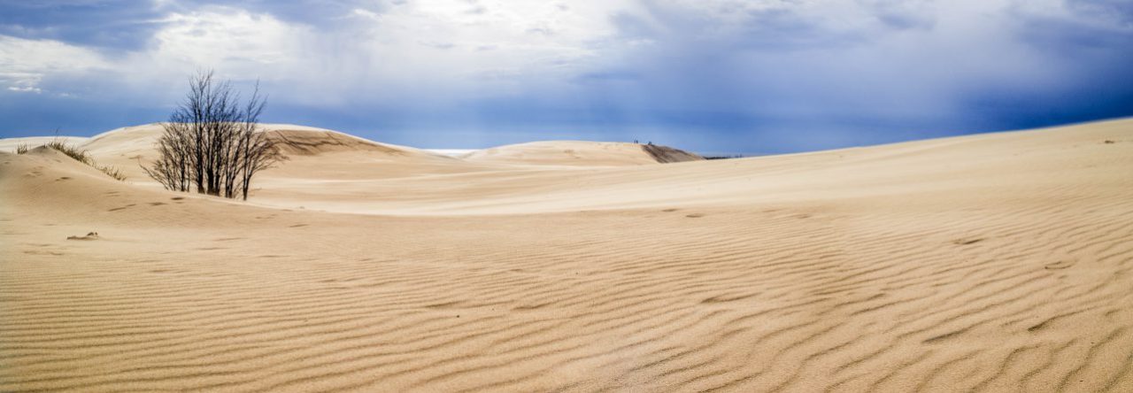
After visiting the ponies, we headed into the Village of Ocracoke. Coming from Hatteras, the first thing you see when you get to Ocracoke is just road and dunes. Once the island widens out, you get through the Cape Hatteras National Seashore and you reach the Village of Ocracoke. Of all the towns in the Outer Banks, Ocracoke has the most character. The small size of the island causes the village to be kind of tight with cars sharing the roads with golf carts, and in some cases, pedestrians and bikers too. There are quirky shops, boutique hotels, and interesting restaurants all without walking distance of each other.

Located in the heart of Ocracoke Village is the The Ocracoke Island Lighthouse, the second oldest operating lighthouse in the US. It is the smallest of the lighthouses of Cape Hatteras Lighthouses, standing at only 75 feet tall (NPS). Like Hatteras Lighthouse, it is an inland lighthouse, but unfortunately, The Ocracoke Lighthouse is not open for climbing. If you plan to check out the lighthouse, be aware there are only 2 or 3 parking spaces nearby. If possible, I would recommend walking or biking to the lighthouse.

Located in the Cape Hatteras National Seashore, a short drive from the Village of Ocracoke is the Ocracoke Campground, where we camped for two nights. One nice thing about this campground is that they have a generator-free loop, meaning you won’t be hearing air conditioning all night long. It seemed like when we were there, most people chose that loop, so we traded generator noise for people noise. We chose a dune-side site so we were able to walk over the dunes right onto the beach which was really nice. One thing that was tough about all of these National Seashore campgrounds is that there was no tree cover and our second day at Ocracoke was rough because it was 92 degrees at ten in the morning and we had to pack everything up. The heat was really starting to take it out of me. I don’t know that I would tent camp on the beach in the summer again. Luckily, we had an hour ferry ride back to Hatteras to cool down and relax.

Thanks for stopping by! If you like my photos be sure to “like” my Facebook Page, follow me on Instagram, and Flickr! To see inside my camera bag, check out my Gear Page. For information about our new Guided Photography Tours, visit GuidedPhoto.com.

Pin this!

Page 3 of 5

Powered by WordPress & Theme by Anders Norén